
Context: Infrastructure Asset Documentation
digital twin case studies
WSP’s Historic Bridge Asset Inventory: Case Study
How WSP used reality capture and Prevu3D to deliver a complete asset inventory of a nationally preserved FDOT bridge, from point cloud to Revit model.
Unlock Case Study

the challenge
Without a current record
-
No model, CAD drawings, or documentation of existing conditions
-
Maintenance decisions made from old hand-drawn plans
-
Massive proprietary files requiring special software and rarely used
-
No intuitive way for stakeholders to explore field conditions
the benefits
With Prevu3D in the workflow
- A complete asset inventory of a nationally preserved bridge, built from scratch
- Faster section cutting and elevation extraction directly in Revit
- A browser-based 3D environment FDOT could navigate without specialized software
- New project work won and internal adoption spread across WSP teams
Get Instant Free Access to the WSP’s Historic Bridge Asset Inventory: Case Study case study
Scan to Deliverable: WSP’s Full Asset Inventory of a Historic Bridge with Prevu3D
How a multi-platform reality capture workflow gave FDOT something they never had: a complete, contemporary record of a nationally preserved structure.
Client: Florida Department of Transportation (FDOT)
Project: Blue Bridge, Full Asset Inventory & Structural Documentation
Scope: Reality capture, 3D modeling in Revit, Prevu3D visualization
The Challenge
When FDOT needed a detailed inventory of a historically preserved steel bridge, they had one major problem: no contemporary model, no CAD drawings, and no reliable record of existing conditions. What they had were old hand-drawn plans and a backlog of deferred maintenance decisions, specifically, a program to replace aging rivets with bolts that nobody could accurately track.
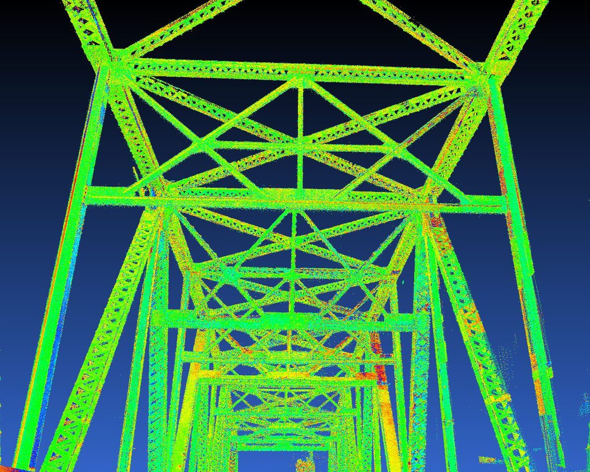 Raw intensity-colored point cloud of Blue Bridge: precise data, but inaccessible without the right tools.
The Approach
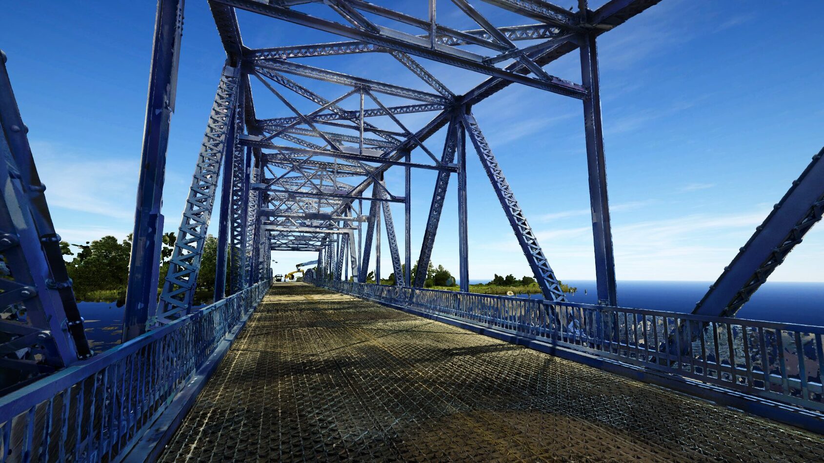
WSP’s Reality Capture team, led by Adam Moutafis, deployed a multi-platform capture strategy combining terrestrial Leica scanners with a Regal VZ600i mounted on a boat to capture the full structure, including beneath the bridge deck from the water.
The resulting point cloud data was imported into Prevu3D, where the team could navigate the environment with spatial precision, cutting sections, examining structural details, and orienting themselves in context before making a single modeling decision.
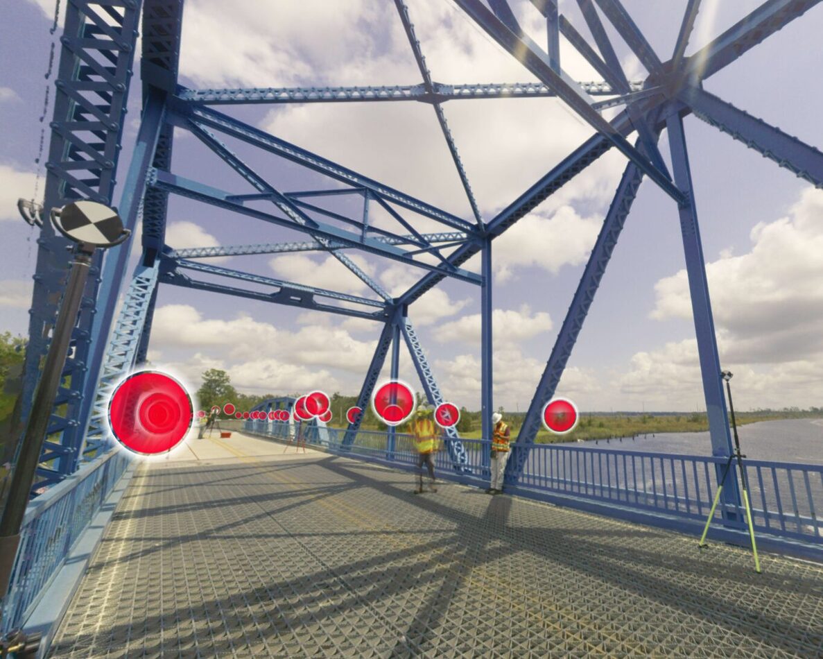 WSP field crew deploying scan targets across the bridge deck during the multi-platform reality capture survey.
From there, the team moved into Revit for full asset modeling using the RealityConnect Revit plugin, bringing segmented data directly into the modeling environment.
We modeled every single bolt, every single rivet on this entire bridge, probably tens of thousands. It took a long time to get it done right.
— Adam Moutafis, Reality Capture Manager, WSP
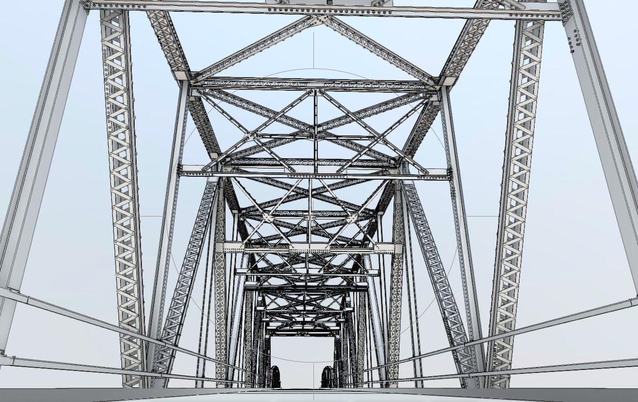
The Revit model delivered to FDOT—every structural element modeled from reality capture data.
Where Prevu3D Made the Difference
Before Prevu3D entered the workflow, deliverables were typically handed off as heavyweight Leica LGS files—proprietary formats that could run tens to hundreds of gigabytes, require specialized software to open, and provided almost no intuitive visual experience for end users.
The result? Data that sat on a drive and was often never used.
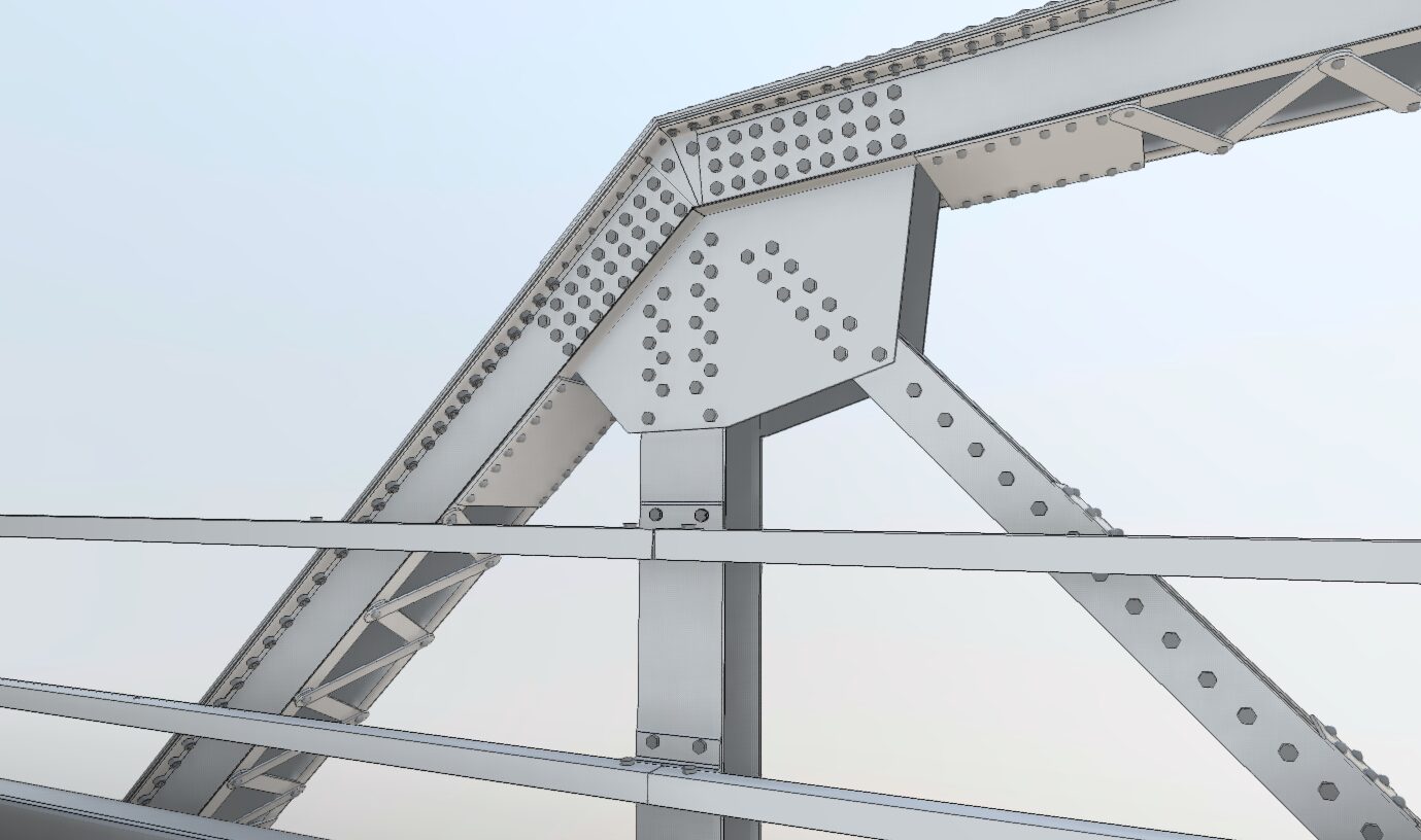
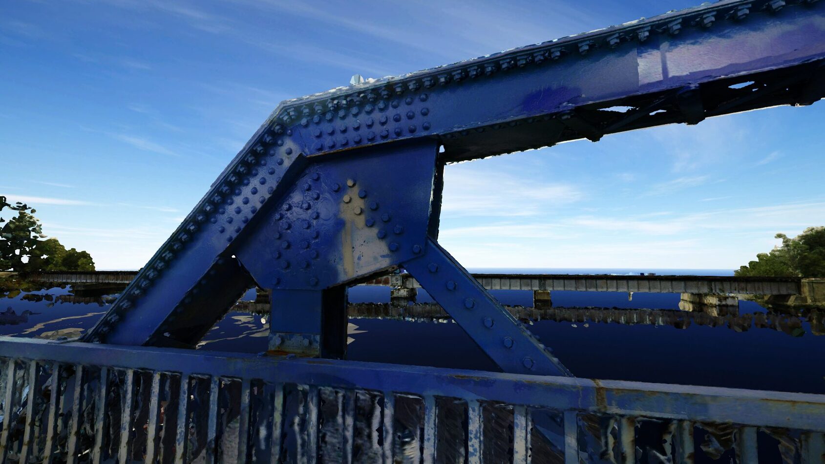 From reality capture to Revit model: the same connection, two views. Every bolt documented, every rivet modeled.
Prevu3D changed the equation. The team was able to load the full bridge model into an accessible, web-based 3D environment, one where an FDOT stakeholder could navigate the bridge deck, zoom into connection details, and immediately understand the spatial reality of the structure.
For the WSP production team, the value was equally concrete. Prevu3D made it easy to cut sections and generate the precise elevation views needed for each structural cross-member, dramatically accelerating the extraction workflow in Revit.
The value was the ease of being able to cut sections and view these things just as they are. Being able to cut this and view it in a way that we’re able to do extraction really cleanly in Revit, it really made our lives very easy.
— Adam Moutafis, Reality Capture Manager, WSP
The Outcome
FDOT received a complete, contemporary asset inventory of a nationally registered historic bridge, the kind of record that simply didn’t exist before. The deliverable gave them a reliable foundation for ongoing maintenance planning and rivet replacement tracking, tied to actual visual documentation of existing conditions.
Internally, the project became a proof point that spread across WSP’s bridge inspection and engineering teams. When colleagues saw how intuitively the Prevu3D model could be navigated, and how much clearer it was than anything they’d worked with before, new project opportunities followed.
“When you give it good data, Prevu3D will do a very good job of making it look nice,” Adam notes. But the real story here isn’t the visuals. It’s what those visuals unlock: faster decisions, stronger client confidence, and data that gets maximized.
about Our Client
About Adam Moutafis
Adam Moutafis is Reality Capture Manager for the southern United States at WSP, where he leads large-scale laser scanning and digital reality capture efforts for complex infrastructure and industrial projects. With a background in land surveying and geomatics, Adam specializes in translating high-density point cloud data into practical, decision-ready outputs for engineers, owners, and asset managers.
Adam will be a featured panelist at Connexion by Prevu3D, an industry event bringing together reality capture professionals to explore how 3D data is reshaping infrastructure delivery.
about us
Prevu3D
Prevu3D is the operational as-built platform for industrial teams—turning reality capture into a connected 3D environment that engineering, operations, and compliance teams can act on from anywhere. Built around three pillars of Capture, Manage, and Connect, the RealityPlatform™ transforms scan data from any source into a navigable spatial environment that connects directly to the tools teams already use: CAD, BIM, ERP, PLM, and IoT systems via RealityConnect™.