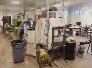

Host and stream reality capture data
Turn reality capture into a connected source of context for the tools your teams already use, so they can design, simulate and decide with a clearer view of what's actually there.
how it works
All your reality capture data, streamed and stored in one platform
Make your 3D scans, 360 capture, Lidar usable wherever work happens. Design, simulate and decide against what's really there, without exporting, moving or reloading files.
Keep the full site in view without loading it all.
Stream the surrounding environment into design or simulation tools, then work with only the assets you need.
Manage reality in one place
Update and organize scans in the platform, not through another round of exports and manual alignment.
Bring it into existing workflows
Use reality data through integrations, applications and embedded viewers; not everyone needs to work in RealityPlatform™.
Get to decisions sooner
Bring reality into traditional tools and AI workflows.
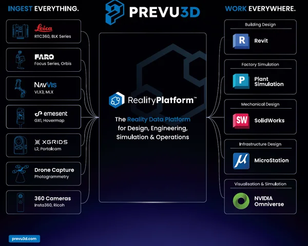
Laser Scanners and Reality Capture Devices RealityPlatform™ Ingests
- Terrestrial laser scanners: Leica RTC360 and BLK series, FARO Focus series and Orbis
- Mobile and SLAM scanners: NavVis VLX3 and MLX, Emesent GX1 and Hovermap, XGRIDS L2 and Portalcam
- Drone photogrammetry for roofs, yards and large sites
- 360 cameras such as Insta360 and Ricoh for fast visual capture
How does it work?
Create a site project
- Enter a physical address or geographic coordinates when creating a new site.
- Enables the Map View feature for an interactive overview of all sites.
- Visualize and navigate between multiple project locations.
- Easily manage sites and enhance operational oversight across facilities.
- Ideal for large-scale operations and scanning project delivery, ensuring organization and efficiency.

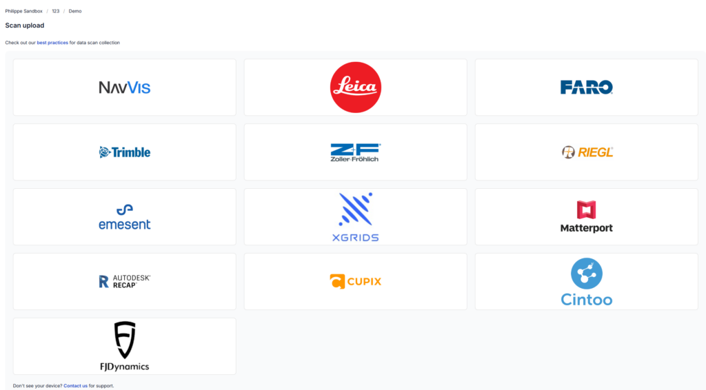
Device-based uploads
- Optimizes workflows for various scanning devices, including traditional scanners and SLAM devices.
- Ensures compatibility and high data quality.
- Requests only essential data like trajectories or scalar fields during uploads.
- Supports expanded file formats for consistent results.
- Enhances reliability and efficiency with a customized pipeline for diverse scanning technologies.
Processing
- Automatic scanning data import and processing upon upload.
- View processed files in the Point Cloud Viewer.
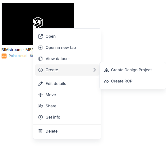
- Export RCP files compatible with CAD software directly from the Point Cloud card.
- Create RealityMesh files from point cloud-to-mesh processing in Prevu3D format.
- Use RealityMesh Files as foundational data for projects in RealityPlan.
- Export RealityMesh as OGC (Cesium tiles) for use in third-party software like Unreal or Unity.

Managing buildings, I must ensure that construction plans are up to date, often requiring on-site measurements and validations. This information is available in our 3D environment on the Prevu3D platform, which is accessible even when working from home or on-site with suppliers.
Read the Case StudyYves Gaudreault
Mechanical Engineer, General Mills