May 15, 2024
Laser scanning with purpose
Download the must-have checklist to plan and maximize your reality capture process
Scanning: a game-changer across industries
Laser scanning technology has revolutionized how we capture and utilize spatial data across various industries. From manufacturing and engineering to architecture, scanning has become an indispensable tool for maximizing reality capture data. In this article, we’ll explore the purpose of laser scanning and its widespread use across complex industries, shedding light on its incredible potential for precision, efficiency, and innovation.
Get free access
Overview of scanning use cases for complex industries
Engineering: In engineering projects, laser scanning is employed to capture as-built conditions, conduct structural analysis, and support the design process, enhancing accuracy and reducing rework.
Oil & Gas: In complex refinery environments, laser scanning is utilized for asset management, plant revamp projects, and safety assessments, capturing intricate details for accurate digital representation.
Automotive Manufacturing: This industry utilizes laser scanning for reverse engineering, quality control, and prototyping of complex vehicle components, ensuring precision and efficiency in production processes.
Manufacturing: Laser scanning is used in manufacturing applications for virtual site visits, dimensional analysis, and process optimization, facilitating efficient production and reducing errors and costs.
Maritime: Laser scanning is employed in maritime applications for shipbuilding, maintenance, and structural analysis, providing detailed 3D data for efficient design and effective maintenance planning.
Aviation: Laser scanning plays a crucial role in aircraft maintenance, enabling precise measurements and assessments of complex geometries, such as engine components and aerodynamic surfaces.
Construction: Laser scanning creates detailed 3D models of construction sites, aiding in project planning, quality control, and progress monitoring.
How to get started with scanning
Defining the goals and objectives of the laser scanning project
The process of laser scanning involves several key considerations to ensure the successful utilization of the gathered data. Firstly, it is imperative to identify the intended purpose of the scan data, whether for design engineering, construction coordination, or other applications. Engaging end-users at an early stage is essential to align deliverables with their requirements. Furthermore, it’s crucial to consider details about the scanning environment, such as whether it’s interior or exterior, occupied or unoccupied, and the condition of the space.
Defining the project scope precisely is key to avoiding costly revisits and scope changes. Specific requirements for deliverables, such as point clouds, 2D drawings, or 3D models, should be clearly outlined, along with preferences for software platforms and file formats. The desired level of detail for each feature, often referred to as BIM LOD should also be specified to expedite the modeling process. Establishing a clear delivery timeline is essential for meeting project deadlines, and coordinating site access by taking safety and security requirements into account is crucial for streamlining the scanning process. By addressing these aspects comprehensively, projects can progress efficiently and effectively.
Key questions for a successful scanning process
Before mobilizing a team for a 3D scan, several key questions should be managed to ensure a successful scanning process. Asking the right questions to define the goals and objectives of laser scanning projects.
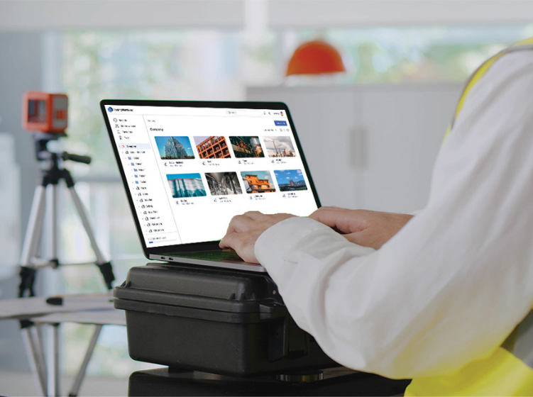
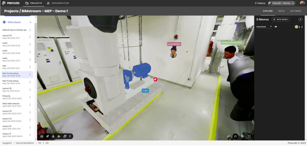
Maximize your reality capture data with Prevu3D software
Prevu3D connects real-world facilities with engineering enterprises and operational data through reality capture. Working with digital replicas of complex environments and assets is the foundational layer for giving visual context to enterprise data.
RealityPlatform
Maximize your reality capture data
By utilizing cloud processing, gaming technology, and AI, RealityPlatform enables organizations to host, process, and manage reality capture data all on one platform opening up the doors for engineers to streamline their workflows like never before.
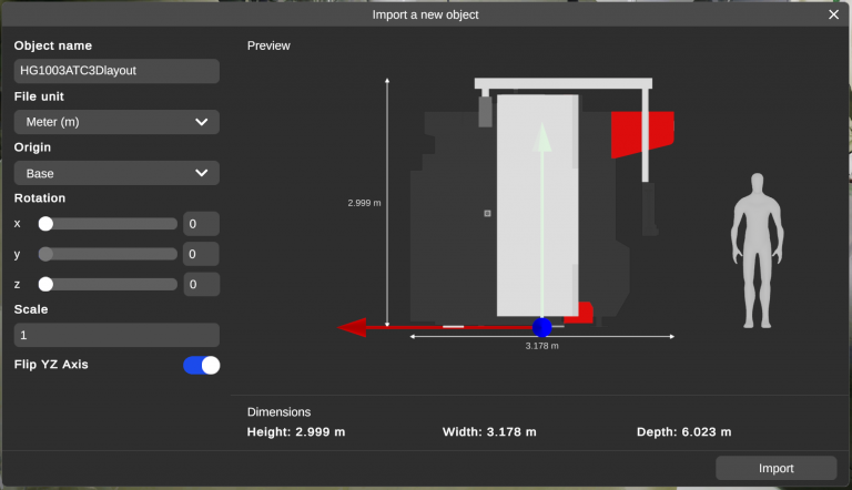
It automatically converts point clouds into detailed meshes, reducing file sizes for improved accessibility without compromising quality or requiring specialized hardware. Through the integration of 3D mesh models, organizations gain a rich visual context and understanding.
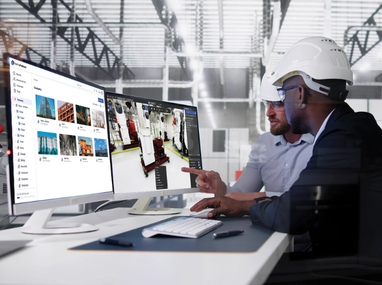
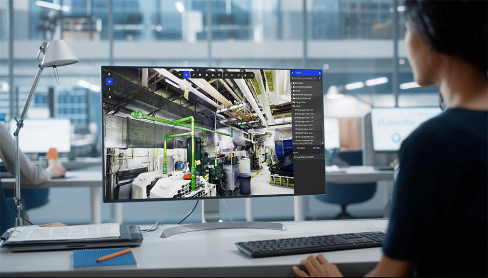
Users can visualize point clouds, CAD designs, meshes, and design layout projects. Advanced navigation styles and various visualization modes help them better comprehend environments. Sharing and collaborating on projects remotely through our web and desktop applications helps save costs and time by minimizing the need for on-site visits.
Our user-friendly interface is designed to be easily accessible to users with varying levels of technical expertise. Users can attach notes, documents, and URL links to assets, collaborate by tagging others for feedback, and provide comments on assets and project files. Additionally, projects can be shared with an unlimited number of users.
RealityPlan
Accelerate your engineering processes
RealityPlan takes visualization one step further by leveraging asset definition tools, allowing users to segment and organize assets. Users can effortlessly cut meshes to create RealityAssets and combine CAD metadata for asset classification, organization, and search.
The solution facilitates quick iteration of design concepts, animation of assets for testing, and seamless export of 3D models to CAD software for integration into existing workflows.
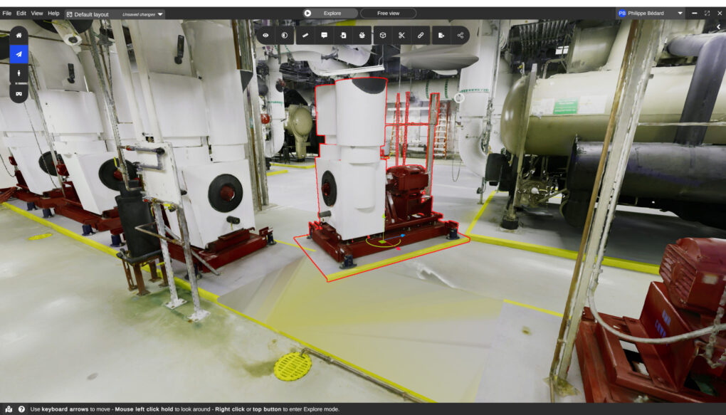
Users can navigate through different modes, zoom in to examine intricate details and gain comprehensive visual context. Analysis can be enhanced by evaluating circulation using avatars and vehicles.
By establishing a centralized source of truth, RealityPlan enables efficient collaboration. Meshed assets can be displayed alongside CAD metadata, while data can be augmented with annotations, documentation, references, and links.
Navigate your reality capture journey with Prevu3D’s partner network
Careful consideration is required when selecting the appropriate device, techniques, and services for capturing an environment. While cost-effectiveness may be tempting, it may not produce the desired results for your project’s goals and company objectives. Engaging with a professional scanning provider is crucial to ensure efficient and effective capture to maximize ROI.
Adhering to laser scanning best practices is essential in creating high-quality digital twins. By prioritizing precision and accuracy during data capture, organizations can effectively leverage digital twins to make informed decisions, improve operational efficiency, and successfully achieve their strategic objectives.
Visit our Partner’s page to find a scanning service provider near you.