




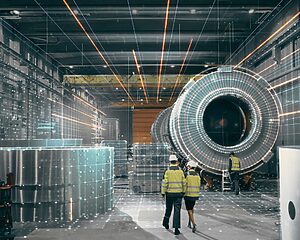

MicroStation Point Cloud Plugin for Infrastructure Design
FAST CAD MODELING TO VALIDATION
Your MicroStation workspace, grounded in reality
Infrastructure design decisions are only as good as the data behind them. RealityConnect™ puts verified, georeferenced site conditions inside MicroStation — so every decision your team makes is grounded in what actually exists.
Validate MicroStation Designs against As-built conditions
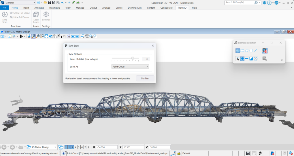
Import Point Clouds & 3D Meshes into MicroStation
RealityConnect™ enables direct import of georeferenced point clouds and photorealistic 3D meshes from RealityPlatform™ into Bentley MicroStation — without leaving your CAD environment.
 How it works:
- Connect MicroStation to your RealityPlatform™ scene library in one click
- Import high-density point clouds and photorealistic meshes of bridges, roadways, tunnels, rail corridors, and utility networks
- Anchor all imported data to real-world coordinates using georeferenced 3D scans
- Design teams work directly within accurate, as-built site geometry from day one
Eliminating the need to manually convert or re-import reality capture data reduces project setup time and ensures your MicroStation models always reflect current site conditions.
Convert Point Cloud to 3D Mesh — RealityAssets™
Large reality capture datasets can slow down CAD workflows. RealityConnect™ lets you segment scenes into focused RealityAssets™ and control level of detail on import — so MicroStation stays responsive even on dense infrastructure projects.

How it works:
- Segment point clouds into named infrastructure elements: girders, piers, deck slabs, abutments, utilities
- Adjust mesh resolution and Level of Detail at import to balance visual accuracy with file performance
- Navigate dense urban corridor scans or high-span bridge models without lag
- Export and share lightweight RealityAssets™ across project teams without bloating file sizes
Optimized assets mean fewer performance bottlenecks in MicroStation and faster handoffs between survey, design, and construction teams.
Design Validation Against As-Built Site Conditions
Compare MicroStation designs against as-built reality in RealityPlan™. Design decisions made against outdated surveys lead to clashes, rework, and costly change orders on site.
RealityConnect™ closes the loop by pushing your MicroStation models into RealityPlan™ for spatial validation against live scan data.
How it works:
- Export updated MicroStation designs directly into Prevu3D’s RealityPlan™ environment
- Overlay design intent on georeferenced point clouds to identify geometric clashes and integration gaps
- Iterate faster by visualizing design changes in 3D real-world context before committing to construction
- Enable remote project stakeholders to review, annotate, and approve designs via web-based RealityPlan™ — no software installation required
- Catching clashes in the model stage rather than on site can reduce rework costs significantly and keeps infrastructure projects on schedule.
 How it works: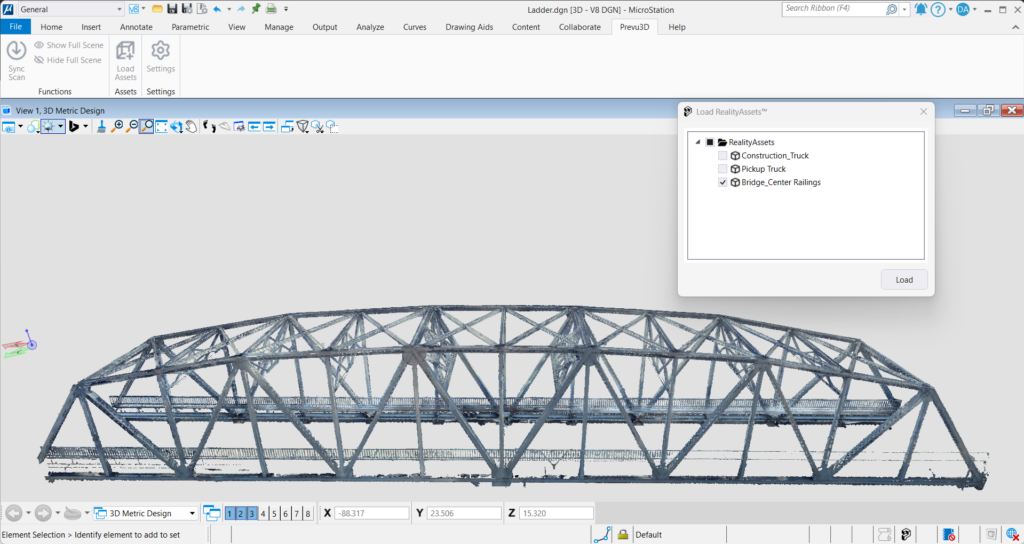
Built for your workflow
Build your infrastructure digital twin, directly in MicroStation
From bridge inspections to plant retrofits — see how infrastructure teams use RealityConnect™ to design faster with as-built data inside MicroStation.
Civil & Infrastructure Engineers
Bridge, tunnel, and highway design validation with LiDAR scan data in MicroStation
Industrial Facility DT Teams
Piping, structural, and utility as-built modeling for plant expansion or retrofit projects
Scanner & Survey Firms
Keep MicroStation-based digital twin models updated with latest reality capture scan data.
MicroStation Point Cloud Plugin FAQ
What point cloud formats does the MicroStation plugin support?
RealityConnect™ for MicroStation supports E57, LAS, LAZ, and RCP point cloud formats, as well as photorealistic 3D mesh exports from Prevu3D’s RealityPlatform™. Files can be imported directly without conversion or external tools.
How does the Prevu3D MicroStation plugin convert point cloud to mesh?
The plugin uses Prevu3D’s RealityAssets™ engine to segment point cloud data and generate lightweight 3D meshes inside MicroStation. You control mesh resolution and Level of Detail (LOD) to balance accuracy with CAD performance. No external mesh processing software is required.
Does RealityConnect™ support georeferenced point clouds in MicroStation?
Yes. Scans imported via RealityConnect™ retain their original georeference coordinates, ensuring accurate spatial alignment with your MicroStation design models. This is critical for infrastructure projects involving GPS-positioned survey data.
Can the MicroStation plugin be used for digital twin workflows?
Yes. RealityConnect™ is designed as a bridge between reality capture data and digital twin creation. Teams can import updated scan data into MicroStation, generate RealityAssets™, and push designs into Prevu3D’s RealityPlan™ and RealityTwin™ for ongoing digital twin management.