RealityTwin™ Feature
Up-to-date scan data
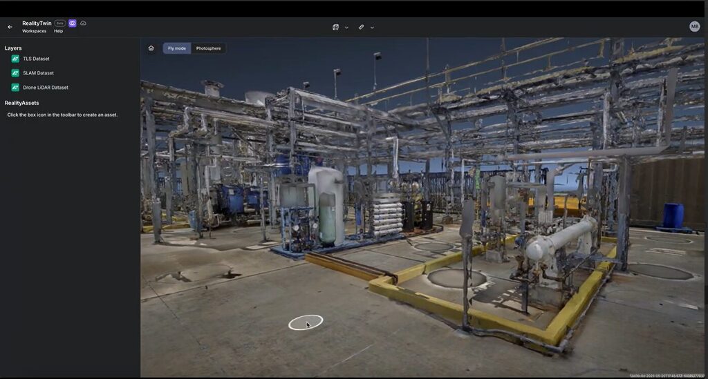
Unify Every Layer of Reality
From scattered scans to a single source of truth
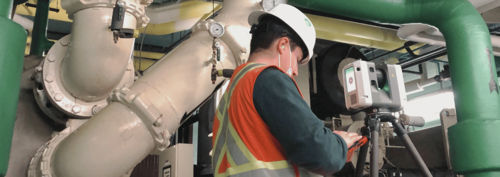
Watch how teams layer SLAM, drone, terrestrial scans and 360° data into a unified digital twin with RealityComposer. See clipping tools and georeferenced alignment in action—all through an intuitive, visual interface.
Benefits at a glance
Multi-Source Compatibility
Supports LiDAR, SLAM, and photogrammetry
Geospatial Accuracy
Auto-align or fine-tune manually
Project Continuity
Built for rescan workflows
Key features of RealityAssets™ across workflows
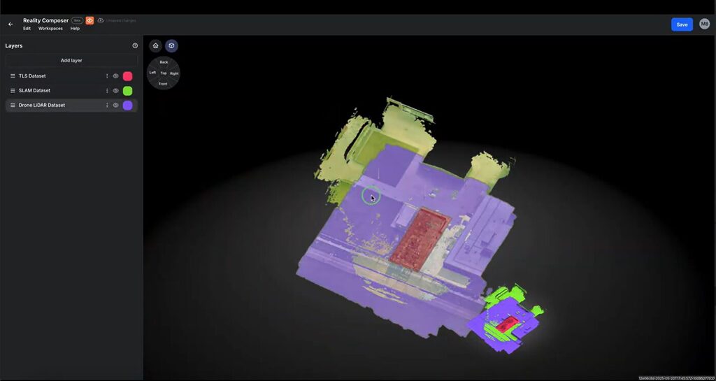
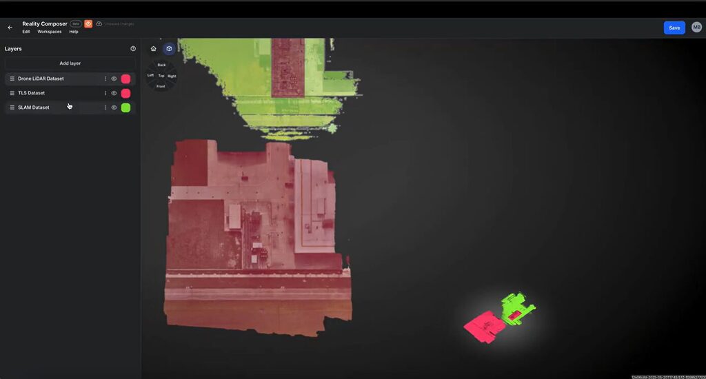
Multi-Scan Alignment
Assemble and align spatial datasets into a single, cohesive visual model.
- Supports a wide range of 3D capture formats, including LiDAR, SLAM, and drone-based scans
- Automatically aligns datasets using georeferencing or control points
- Manual tools available for precise alignment adjustments
- Clean up noise, clutter, or irrelevant data directly in the workspace
- Update and expand facility models over time without starting from scratch
Multi-Source Scan Assembly
Bring together data from various 3D capture technologies into one connected spatial model.
- Import and organize LiDAR, SLAM, drone, and 360° datasets in a single project
- Assemble scans from different sources without preprocessing or format conversion
- Maintain spatial continuity by placing non-overlapping scans side by side
- Group scans by zone, floor, or time to support progressive buildouts
- Build a comprehensive facility view regardless of device type or vendor
Georeferenced Precision
Ensure spatial accuracy across layered scans with robust georeferencing tools.
- Auto-align with control points or manual tools
- Maintain consistent spatial integrity through rescans
- Foundation for asset tagging and traceability
- Support integrations of future retrofits, turnarounds and layout updates
WEB-BASED PLATFORM
Visually unify reality capture scans and enterprise systems of record in one persistent, operationally rich model with RealityTwin™ that delivers context tailored to each team’s needs.
Explore our RealityTwin™ Resources
Book a demo
Schedule a personalized walkthrough
Explore how RealityTwin™ can transform the way your teams operate, maintain, and collaborate — whether onsite or remote.
With RealityTwin™, you can:
- Eliminate time spent manually verifying site conditions
- Keep assets, documentation, and visual context unified
- Reduce costly surprises during inspections, maintenance, or asset interventions
- Deliver the right data to the right people without overload
- Scale operational visibility across teams and facilities